Aogashima Island Travel Blog / Tourism Guide
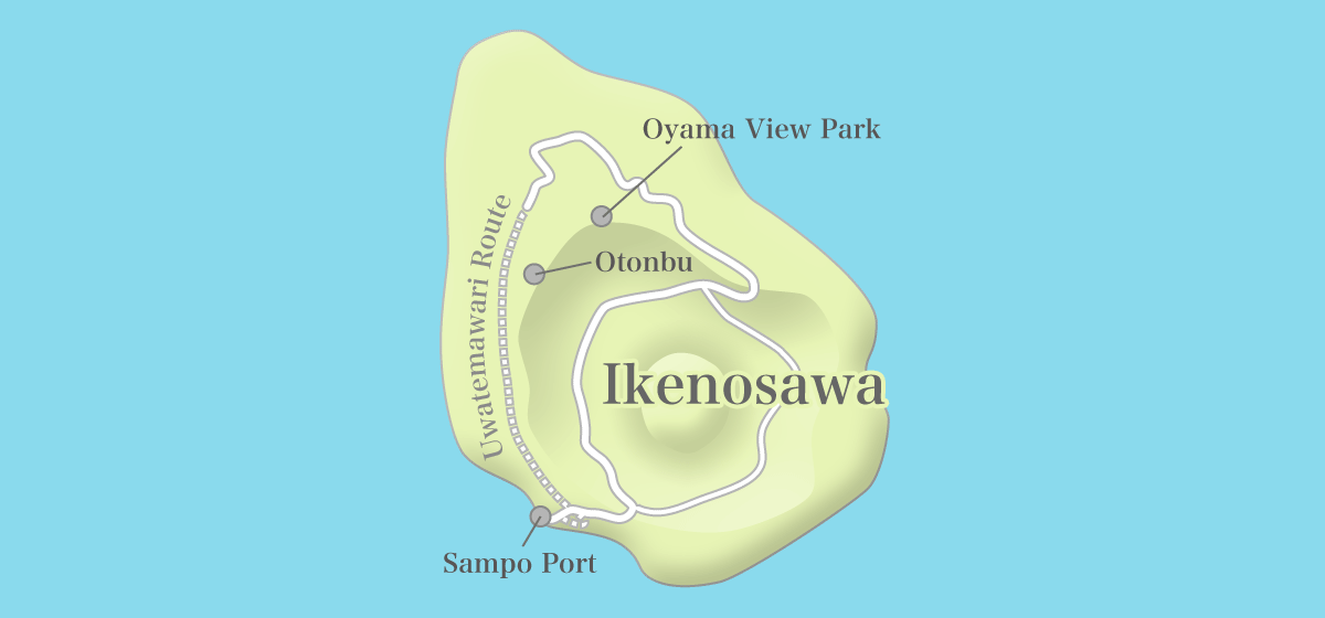
Otonbu, Oyama View Park, Uwatemawari Route
Contents of This Report
Otonbu
Otonbu is located at the highest point of Aogashima. You can overlook Ikenosawa from the observatory located at an altitude of 423m. It is at the top of the somma of the compound volcano.
- Going up the slope in front of NTT.
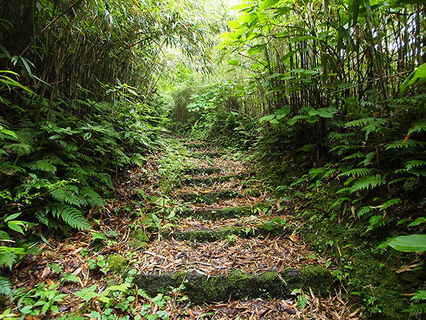
- Going up the staircase of the promenade.

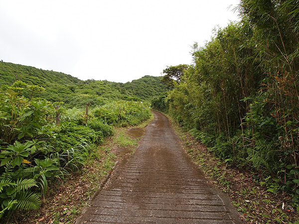
It took me less than 30 minutes on foot from Business Yado Nakazato to the observatory. The road is called "promenade", but it is a normal mountain path, so you should take measures against harmful insects in summer.
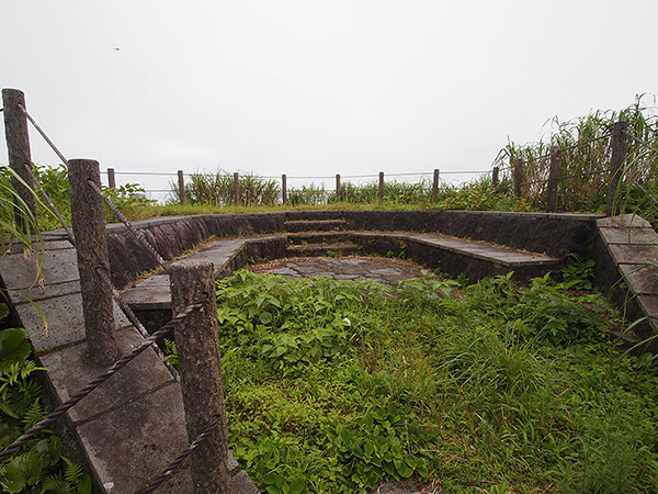
- Arrived at the Otonbu observatory.
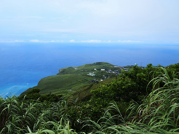
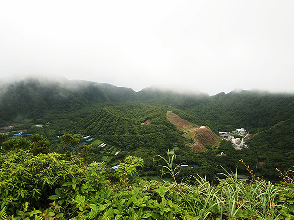
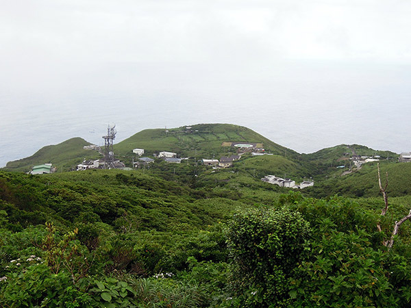
- Overlooking the north of the island from Otonbu.


- Overlooking Ikenosawa from Otonbu.
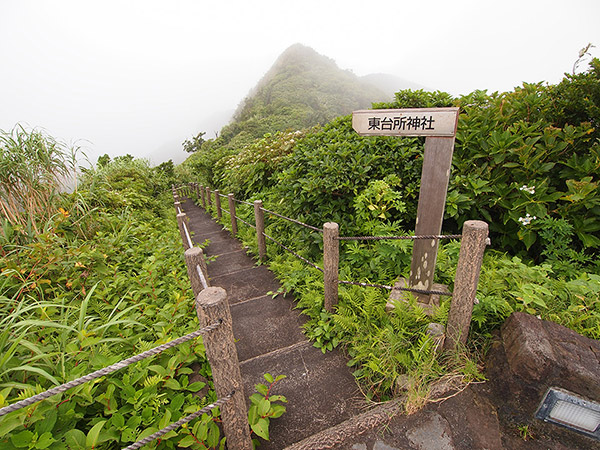
- A road to Todaisyo Shrine.

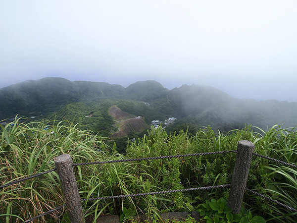
Unfortunately, the clouds were hanging over the whole island that day and the scenery was covered by fog. And also, it does not come through in this picture, but the observatory area was like territories of drone beetles and dragonflies, so some insects were constantly buzzing. I could not calm down. I will not recommend you to visit there in summer.
Mukaizawa-shusuijo and Oyama View Park
It has a problem of water source, which many remote islands have. In a remote island which has no river or lake, water is often scarce. Aogashima is no exception and I heard that each house used to store rainwater once. What solved the problem of water source in Aogashima is "Mukaizawa-shusuijo", which was started in 1979. The hillside bedded in concrete can store rainwater in the reservoir.
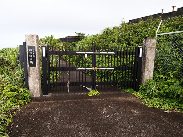
- The entrance of Mukaizawa-shusuijo.
- Mukaizawa-shusuijo is a facility which is used for collecting rainwater.
I heard that it was so severe that it was said they used to drink water which mosquito larvae bred in, but this waterworks facility was built and water has been stably supplied. In addition, on the top of Mukaizawa-shusuijo, there is a radio wave tower of Docomo.
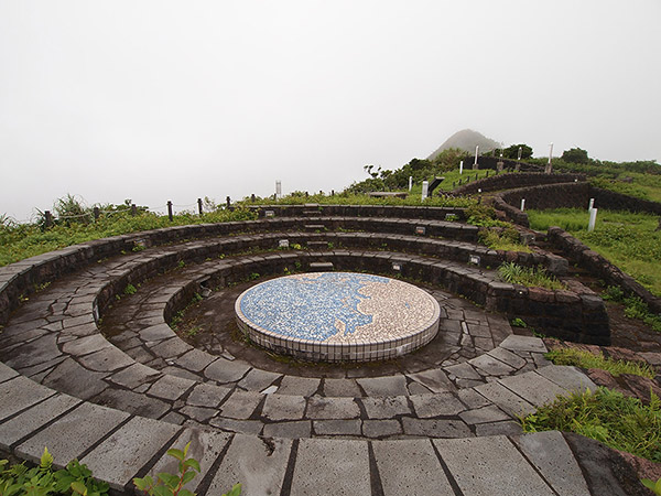
- Oyama View Park was enveloped in fog.
Oyama View Park is a observatory, which is at an altitude of 400m. The road which diverges on this side of Mukaizawa-shusuijo leads to Oyama View Park. Unlike Otonbu, all it takes is going up a paved road, so I will recommend it to you in the sense of easiness to visit.
- Ikenosawa seen from Oyama View Park.
- Overlooking the village direction.


The top of Oyama View Park forms a circle, an elaborated design, and there are few buzzing insects (lol). You can overlook both the village and Ikenosawa. However, Ikenosawa was enveloped in a fog again.
Uwatemawari Route
Uwatemawari Route (upper bypass) is a road along the outside of the somma of the compound volcano. It is the shortest route between the village and Sampo port, but unfortunately, it is currently closed to traffic. Today, if you want to go to the village from Sampo port, go through Seiho tunnel and go into the caldera crater of Ikenosawa. And then, go up Nagashizaka hill, get to the top of the somma and take a road to the village from the east side. It is a roundabout way, but it is the only route.
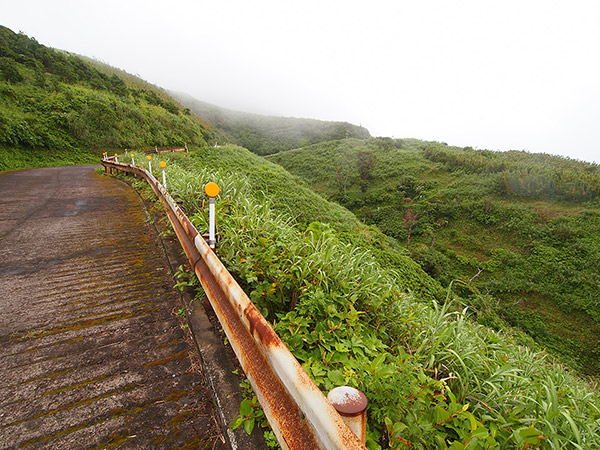
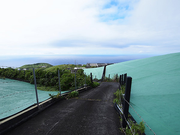
- A gentle uphill road continues from the village.

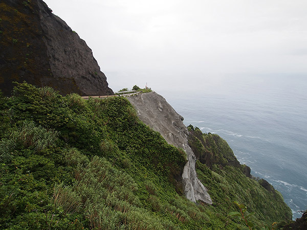
Due to the swarm earthquakes which occurred in 2001, some locations of Uwatemawari route were collapsed. The largest collapse is a landslide which you look up at from Sampo port, but other locations also seem to have been collapsed. It has been more than 10 years since the collapse, but because it has topographical difficulty of sheer cliff and fragile volcanic geological features, the construction is going far from smoothly. Anyway, I tried going on as far as possible from the village side.
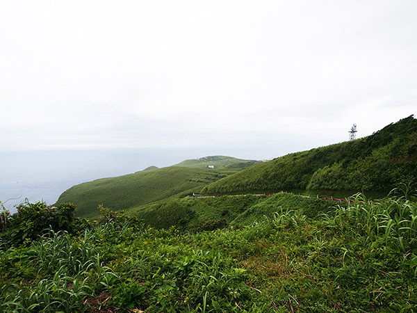
- Looking back at the village.

It was cloudy on that day. Uwatemawari route is located at a high altitude and often enveloped in fog. When I realized it, the field of view was white.
- The fog was gradually getting dense.

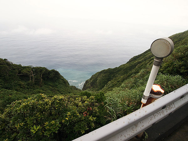
This road runs at a high altitude and you cannot see the coastline even if you look over the precipice. The same twisty road continues forever. Then, a truck came running from behind and overtook me. Cars cannot possibly go through this road… I think. Was that a construction vehicle?
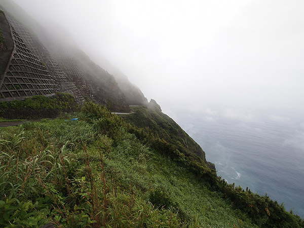
- The difference in elevation is so big that the coastline cannot be seen.
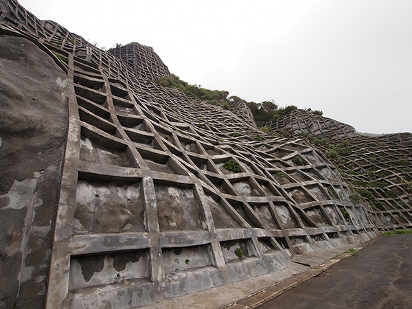
- The inclined plane is reinforced finely.
Walking for about 40 minutes, I found a sign which shows "Collapse site". But it did not look like it has collapsed only at a glance.
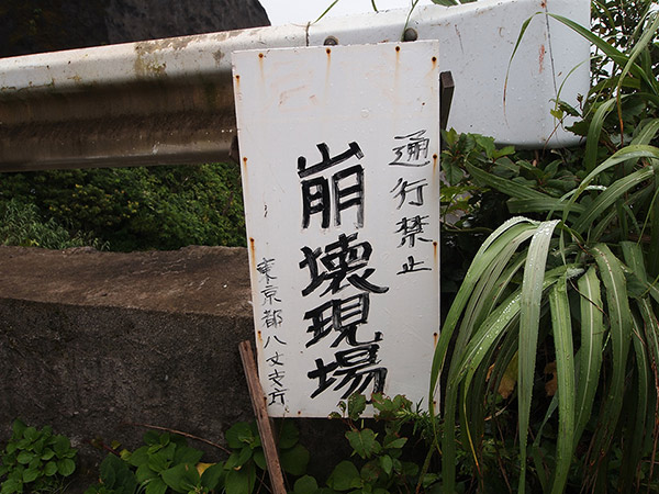
- Arrived at a collapse site of the road.
When I looked carefully, the tip of the collapse site over there is bedded in concrete. I think that it is the trace of the restoration of a large-scale collapse site.
- The trace of a large-scale repair work can be seen.
Many fallen rocks were scattered around here, and I do not know whether it is because of an impact of fallen rocks, but there were some cracks on the road surface. Even if it is restored, a collapse happens one after another. It is fate of Aogashima. It will take more time for restoration works to finish.
- Visit Day
- 2011/08/07 - 10
- Contents of This Report